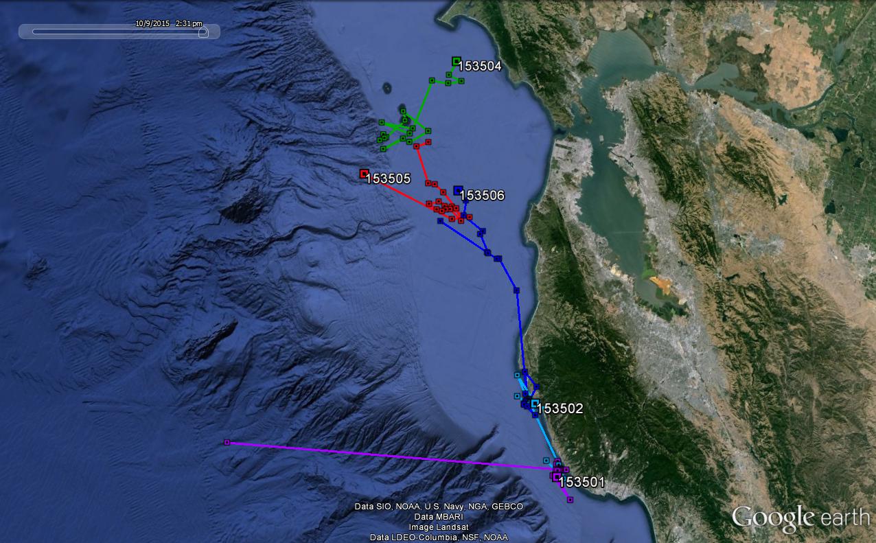
We are deploying two types of satellite tags on juveniles, a SPOT tag (stands for satellite position only tag) and a SPLASH tag (it collects both location and dive data). While I certainly don’t understand all of the ins and outs of how the tags connect to satellites, I understand the basic concepts. Both of the tags transmit data over the ARGOS system, which is attached to polar-orbiting satellites. When the animal surfaces, the tag attempts to connect with the satellites – if there are no satellites overhead then we will not get a position on the animal. Satellite coverage varies depending on where you are and the time of day – we are pretty luck in California as satellite coverage is good. If there are enough satellites overhead and the tag is able to connect several times with the satellites, then it is possible to get a position of the animal via the Doppler effect. Whenever we get an ARGOS location, we also get a location quality, which is simply a value that tells us the error (in km) about the position. ARGOS positions can be accurate from ~1 km to up to ~70 km. This error doesn’t matter as much for an animal, like an elephant seal, that travels thousands of km at sea, but for a sea lion that is coastal it can be a bit more of a problem.
We can use tags that are equipped with GPS technology to get more accurate positions. These of course come with a tradeoff as they are more expensive and can be larger/heavier. The SPOT tags are about $1400, whereas our GPS tags (that also collect dive data) are $5K. Because of the larger size, I was looking for an older juvenile that could carry the tag without it affecting his behavior. This is always a concern when deploying tags of any kind on animals as many researchers are attempting to measure the natural behavior of the animal. Attaching any sort of instrument to an animal is going to alter its streamlined shaped and create some sort of drag – our purpose is always to minimize this so we don’t affect the animal’s energetic expenditure or its ability to find food.